For our group inquiry project we are looking at how Google mapping products can be used in the classroom to increase relevancy and interest for learning.
I personally believe there are almost limitless ways that maps can be included in the classroom, either paper maps or digital. The mapping and GIS technology that is available today can help students look at their communities and world in amazing ways. Talk about connection to place!
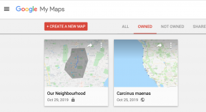 Google has a lot of really cool mapping (and exploration) tools that education environments can take advantage of. What I’m most interested in is how students can make maps themselves. One of the easiest ways to do this is with My Maps. This different from Google Maps which is more for looking up information. In My Maps, you can:
 Add Points, lines, shapes
- Attach photos, videos, links
- Calculate routes, perimeters, areas
- Place markers along a route
- Save and share the map to collaborate
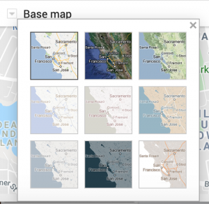
- Use different base maps
- Change the icon images
- Save different information in different layers
- Icons can be coloured based on numerical data – colours will then show information
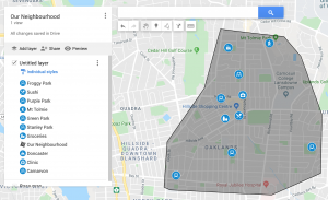
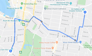
You could use maps like this in the classroom to describe points of interest in the neighbourhood, province or world. Students could add photos or videos, even audio of their voices talking about the locations. They can delineate different areas, show them in various colours, and calculate their areas and perimeters. The measurement tool can be used to measure distances without adding shapes or lines to the map. You can plot routes for car, walking, public transport or bike.
Students could create a tourism map for a location they have studied in class. They could delineate where different languages are spoken throughout the world, and give examples for different words. They could plan a real or imaginary trip, calculate the distances, travel time and mileage. They could map the locations from novels and other fiction. Or map information about their class – house locations, birth places, locations people have visited, free wifi locations, make field trips maps – for parents ahead of time, or to reflect on a trip after the fact. The additional information they add for points along the way in any of these scenario has a lot of value.
Information can be separated into different layers – e.g. historical events can be separated by time periods, or species information can be saved separately. You can print maps from here, or export to PDF.
In terms of simple map making, My Maps has a lot of functionality that could be easily brought into the classroom. There is no software cost, and it is browser based so it’s accessible anywhere.
Here’s a tutorial from another teacher on how to make and annotate a map:
Leave a Reply